Europe
Europe
470 airports · 11.8 x 11.8 in (30 x 30 cm)
$428In stock · Ships from the USA
Bring real-time European skies to your wall or desk!
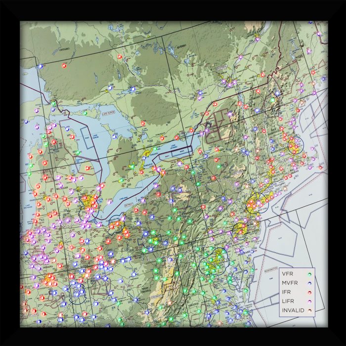
This fully finished, framed LED Aviation Weather (METAR) Map shows the latest conditions at 470 airports across Europe, from Ireland and Portugal to Scandinavia, the Baltic states and Greece, plus western Turkey and parts of North Africa. It comes plug-and-play: just plug it in, connect to Wi-Fi, and enjoy live updates every 15 minutes.
A perfect gift for pilots, students, or aviation enthusiasts.
Ships in 5 to 7 days
Plug and play, Wi-Fi needed
Live FAA data, no subscription
Handmade in the USA
Airports included470
EICK, EINN, EGPL, EGPO, EGPA, EGPB, ENGM, ESOH, EFMA, EETN, EETU, ULOO, UMMS, LRIA, LBWN, LBBG, LTBU, LTBG, LTBF, LTBD, LTFE, LGKO, LGSR, LMML, LICD, DTMB, DABS, DABT, DAOB, DAOO, GMTT, LERT, LPFR, LPBJ, LPPT …
Show all 470
LPMR, LPPR, LEVX, LEST, LECO, LEAS, EIDW, EGAE, EGPU, EGPE, EGQK, EGQS, EGPC, ENHD, ENRY, ESOK, ESOW, ESSA, EEKA, EEPU, EYVI, LRSV, LRBC, LTFD, LTBJ, LGSM, LGNX, LGPA, LGKL, LICB, DTTA, DABC, DAAS, DAOI, LEAM, LEGR, LEMG, LEJR, LEMO, LEZL, LEBZ, LELN, LEXJ, LFRQ, LFRB, EGHQ, EGAA, EGPI, EGPD, ENZV, ENTO, ESOE, ESSB, EEKE, EVRA, EYKA, UKLI, LRBV, LROP, LRBS, LBGO, LGAL, LTBH, LGMT, LTBL, LGHI, LGMK, LGSO, LICC, LICZ, DABB, DAAV, DAAE, DAAG, LEBA, LESA, LEVD, LEBG, LEBB, LFRH, LFRJ, EGOV, EGAC, EGEC, EGPK, EGPF, EGPH, EGQL, ENCN, ESGT, ESSP, ESKN, EVVA, EYSA, LRBM, LRTM, LBPD, LGLM, LGAV, LGAD, LGKF, LICR, LICJ, LICT, LELC, LEMI, LEAB, LEMD, LETO, LEVT, LFRV, LFRT, EGTE, EGFF, EGGP, EGNT, EKYT, ESGP, ESGG, ESGJ, ESSL, ESSV, EVLA, EYPA, EPLB, LRSM, LRCL, LRSB, LRCV, LBSF, LGSK, LGRX, LICA, LIEE, LEIB, LEAL, LEVC, LETL, LELO, LEPP, LESO, LFBZ, LFRZ, LFRN, LFRD, EGDY, EGVA, EGCC, EGNM, EGNV, EKVJ, EKKA, EKAH, ESMT, ESMX, ESMQ, UMKK, EPSY, EPMO, EPWA, EPRA, EPRZ, LROD, LYNI, LWSK, LGTS, LGBL, LGPZ, LIED, LEMH, LEPA, LEZG, LEHC, LFBP, LFBD, LFBH, LFRI, LFRS, LFOV, LFRC, EGVN, EGBB, EGNX, EGXW, EGNJ, EKEB, EKBI, ESTA, ESDF, EPGD, EPLL, LZKZ, LHDC, LRAR, LRTR, LYBT, LYBE, LYKV, LWOH, LGKZ, LGIO, LGKR, LIEO, LIEA, LEBL, LERS, LEDA, LFBG, LFJR, LFRM, LFRK, EGVO, EGLL, EGWU, EGXC, EDXW, EKSP, EKOD, EKRK, EKCH, ESMS, ESMK, EKRN, EPBY, EPKT, EPKK, LZTT, LHBP, LDOS, LQTZ, LYPG, LATI, LIBN, LIBG, LIRN, LFKF, LEGE, LFBO, LFBA, LFBE, LFBU, LFBI, LFOT, LFRG, LFOH, EGKK, EGLF, EGGW, EGYM, EKSB, EDAH, EPSC, EPPO, EPWR, LKMT, LZZI, LHPP, LQSA, LYTV, LIBR, LIBD, LIBF, LIRA, LIRF, LFKS, LFKJ, LFMP, LFMK, LFBX, LFOE, LFOP, EGLC, EGSS, EGUL, EGSH, ETNS, EDHK, ETNL, EDDB, LKPD, LKTB, LZPP, LHSM, LQBK, LQMO, LDDU, LIBP, LIRS, LFKB, LFKC, LFTH, LFML, LFMT, LFCK, LFSL, LFBL, LFLX, LFOZ, LFPN, EGMD, EGMC, EHKD, EHLW, EHGG, EDWE, ETMN, EDHL, EDDC, LKPR, LZIB, LDZA, LDSP, LIRZ, LFMN, LFMD, LFMU, LFCR, LFLW, LFLC, LFPO, LFPB, LFOB, LFAT, LFAC, EHAM, EHLE, EDDW, EDHI, EDDH, EDDP, EDAC, LKKV, LOWW, LJMB, LDZD, LIPY, LIRQ, LIRP, LFMV, LFTW, LFMH, LFLN, LFPG, LFAQ, LFQQ, EBOS, EHWO, EHRD, EDDV, EDVE, EDBC, EDQM, LOWL, LOWG, LDRI, LDPL, LIPR, LIPK, LIMJ, LIMZ, LFLS, LFLL, LFOK, EBCI, EBBR, EBAW, EHGR, EHVK, EDLV, EDDG, EDLP, EDVK, EDDE, LOWS, LOWK, LJLJ, LJPZ, LIPE, LIMP, LIMF, LFLB, LFGJ, LFSD, EBLG, EHBK, EHEH, EDLN, EDDL, EDLW, ETHF, EDDN, EDDM, LIPQ, LIPZ, LIPX, LIPO, LIML, LIMC, LFLP, LSGG, LFSN, LFJL, ELLX, ETNG, EDDK, EDGS, ETIK, EDMA, EDMO, LIPA, LIPH, LIME, LSZA, LSGS, ETAD, EDFH, ETOU, EDDF, EDJA, LOWI, LSZS, LSZC, LSME, LSZB, LFSB, EDDR, ETAR, EDFM, EDDS, EDNY, LSZR, LSZH, EDTL, LFST, EDSB
About this map
Track real-time aviation weather across Europe right from your wall or desk!
This LED METAR Map covers 470 airports across Europe, from Lisbon, Madrid and Dublin to Oslo, Stockholm, Warsaw and Athens, with western Turkey and parts of Morocco, Algeria and Tunisia. Each airport’s LED shows its current conditions. It’s made for pilots, aviation enthusiasts, or anyone who loves watching the skies.
Your map arrives fully framed and plug-and-play, power adapter included. Just connect to Wi-Fi and power, and it will start fetching live METAR data, updating every 15 minutes.
Why choose our map?
✈️ Covers the major METAR-reporting airports of Europe, plus western Turkey and parts of North Africa — 470 total, compared to the 30-40 on most maps.
✈️ LEDs change color automatically based on current airport conditions.
✈️ LEDs blink to indicate high winds, keeping you visually informed (you can turn blinking off).
✈️ Ready to hang or display out of the box — no assembly needed.
✈️ Compact square design: 11.8 x 11.8 inches (30 x 30 cm) fits perfectly on any wall or desk.
LED Color Coding:
✅ Green: VFR
✅ Blue: MVFR
✅ Red: IFR
✅ Purple: LIFR
✅ Orange: No current report
✅ Flashing: High winds
Whether it’s for a birthday, a new checkride milestone, or simply to add a unique aviation centerpiece to your space, this map is a gift that impresses.
What the colors mean
Green VFR, blue MVFR, red IFR, purple LIFR.
Orange: No current report.
A flashing LED means high winds (you can turn flashing off). Updates every 15 minutes from the FAA.
Setup
Hang it, plug in the included power adapter, join your Wi-Fi from your phone. About two minutes. No app or account.
Shipping
Shipping costs show in the cart before you pay: a flat US rate by map size, and international rates by country.
Size
11.8 x 11.8 in
30 x 30 cm, frame included
Airports
470
475 LEDs in all
Power
Wall adapter
Included in the box
Data
FAA, live
Every 15 minutes, no subscription
Own this map? Tell other pilots what you think.